
Maps and GIS
 The maps listed below were created using the Town of Hanover's Geographic Information System (GIS) currently under development by the Town Planner, Public Works Superintendent, and Assessor, along with other town departments. Additional maps will be added as they become available. If you have questions or comments regarding GIS, please contact the Town Planner.
If you are unable to view or open the following maps, please download and install Adobe Acrobat Reader.
Maps of Hanover
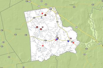
General Maps
- Hanover Street Map (2015)
- Hanover Street Atlas (2005) - Includes Road Names and Index
- Hanover Street Map (2005) - Includes Roads, Parcels, Buildings, Wetlands
- Hanover Street Map (2005) - Includes Roads, Parcels
- Hanover Illustrative Wall Map (2005) - Includes Roads, Parcels, Buildings, Wetlands
- Route 53 Town Map (24'x36') - Maps indicate approximate locations of wetlands, parcels, buildings, and the aquifer protection district.
- Route 53 Corridor Map (11'x17') - Map for Route 53 Corridor
- Scenic Roads Map - Indicates Hanover's Designated Scenic Roads
Assessing
Elections
Historical Commission
- Historic Buildings in Hanover
- Historic Districts and Scenic Roads
- Historic Objects, Bridges, Sites, and Burial Grounds
- Potential Historic Districts and Scenic Roads
- Scenic Landscapes, Trails, and Views
Open Space and Trails
- Trail Maps and Historic Areas
- Hanover Greenway Trails Map (June 2008)
- Hanover Greenway and Open Space Map (1999)
- Five-Year Action Plan Map (2008)
- Open Space Inventory Map (2008)
- Plant and Wildlife Habitat Map (2008)
- Scenic Resources and Unique Environments Map (2008)
- Soil Features Map (2008)
- Water Resources Map (2008)
- Zoning Map (2008)
- Summer Street Site (John Vielkind)
- Willow Road Site (Patrick Vielkind)
Zoning
- Hanover Zoning Map (2014)
- Hanover Zoning Map (as of May 3, 2010)
- Hanover Zoning Map (as of 2000) (Does not include amendments since 2000)
- Hanover Zoning Map - Adult Use Overlay District
- Hanover Historical Zoning Maps
Associated Boards, Committees, Departments
- Assessing | Board of Assessors
- Building and Inspection Services
- Conservation | Conservation Commission
- Historical Commission
- Open Space Committee
- Planning | Planning Board